
We've been exploring the backcountry of the Sierra Nevada for years now, us Buckeyes. We call ourselves Buckeyes because we call this exploration The Buckeye Brothers Festival of Fools. Don't ask me why, lots of alcohol brought it about. Of course, this "Festival" never really ends. Sometimes it even delves into the nearby desert basin and range country, or drifts thousands of miles north or south depending on where we are any given time of year.
 Right now one Buckeye (Nate) is in Prince George, British Columbia, another (Ryan) is in Ocean Beach near San Diego, another (Ted) in Palo Alto near San Francisco, and a couple of us (Me and Todd) are holding down headquarters here in Bishop and Mammoth. Yet we all manage to coagulate into one group every summer for some sort of long trip into the High Sierra. For some of us these mountains gave birth to our adulthood, and for all of us this Sierra wilderness is where our friendship was born, so we feel a sort of nostalgia for this particular piece of earth. It is like Home, yet vast and wild and still unknown.
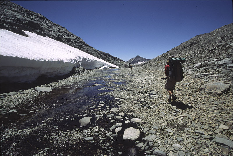 Our trips generally stick to the high alpine, traveling cross-country from lake basin to lake basin, but this year we decided it was time to break the shadows, and solve the mysteries of some of the Sierra's wildest canyons, starting with a 14 day trip that included descending Goddard Creek, and then ascending The Enchanted Gorge. Both of these canyons drain from the Ionian Basin area of the Central Sierra, west of Muir Pass, an area The Buckeyes know well from several previous journeys. On this trip we also included the White Divide region and one of the Sierra's most remote lakes: Tunemah Lake.
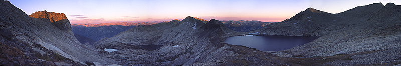
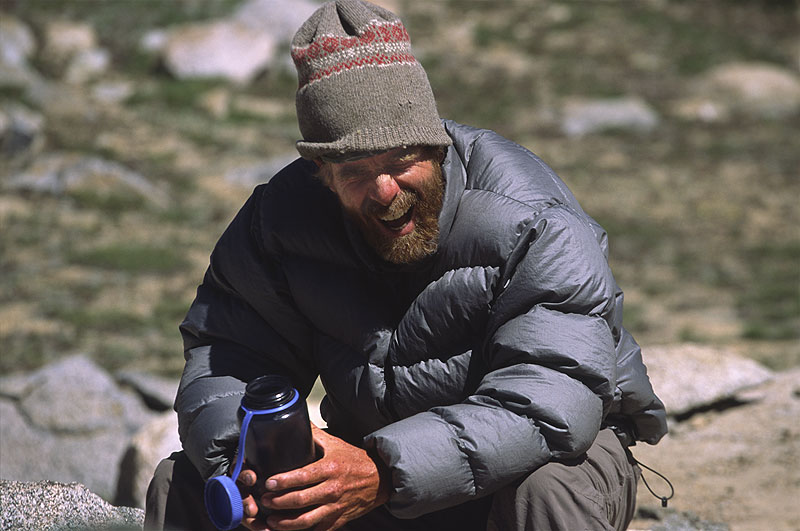
It all came together at the North Lake trailhead parking lot in a thunderstorm. We sat in our cars, and yelled back and forth. Todd, Nate, and Ryan had just finished a couple weeks of backpacking through the LeConte Divide, Ryan already on his way back to Ocean Beach, and Ted and I were hopping on board for the next two weeks of backpacking. Sort of like a backpacker's version of the Festival Express. We came prepared with flasks of Wild Turkey and other things Northern California is famous for.
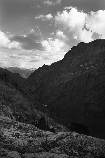
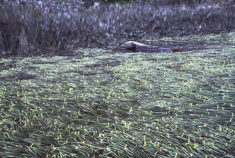
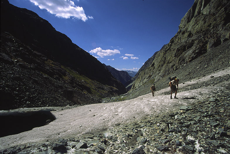
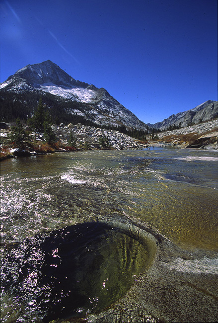
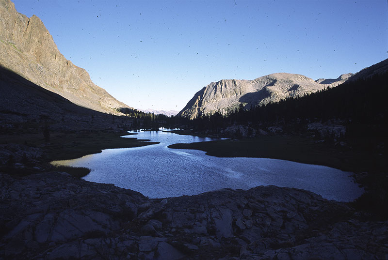 Starting over Lamarck Col broke me and Ted down a bit, but we survived. Packs were heavy. Todd and Nate were already seasoned and moving fast. By the third day we were crossing Wanda Pass, and traversing the Ionian Basin headed for Lake 10,232 which lies between the Ionian Basin and the White Divide. It was great to see the Ionian once again—a remarkable, rugged moonscape with so many colorful, interesting rocks. But lake 10,232 really blew our minds. A beautiful slope drops you from the Ionian Basin to the lake shore, passing numerous cascades and incredible waterfalls, walking through luscious wildflower gardens. Ending up near the north end of the lake you stare into a vertical triangular cliff face that disappears into the deep water, earlier in the season there is probably an amazing little waterfall pouring off of it. The lake shore is steep on this east side and wants to pull you into the water, as Ted found out. Lake 10,232' sits at a joint between the granitic White Divide, and the metamorphic Ionian Basin. The east shore is red and black and brown, with green grasses and flowers and lots of water running, and the west shore is brilliant white-grey, with less grassy vegetation and more trees interspersed among the slabs of granite. The lake is partially embraced by a sub-alpine forest of lodgepole pines, and there was fresh bear scat near our camp.
We took a layover day here and climbed up onto the Ragged Spur, which is the metamorphic dividing ridge between Goddard Creek and The Enchanted Gorge. Walking along its crest we looked down on what little we could see of both, and stared out at one of the finest Sierra views. There was a meadow that caught our eyes over on the Black Divide, hanging above the upper part of The Enchanted Gorge. Ted thought it looked absolutely wonderful, and we all discussed how beautiful it appeared to be, sitting amongst a sea of broken rock, like this little piece of Heaven. The more we looked at it, and studied the slope leading up to it and beyond, we realized what a wonderful alternate exit out of the Enchanted Gorge it would make. Instead of slogging up loose scree to Chasm Lake, we could follow steep benches up to this piece of Heaven meadow and then follow a drainage up over a slight pass next to Charybdis Peak, taking a more direct line. Ted was amazed, "You mean to tell me we're actually going to go to that meadow?!"
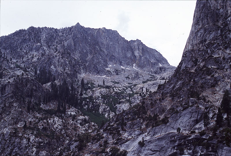
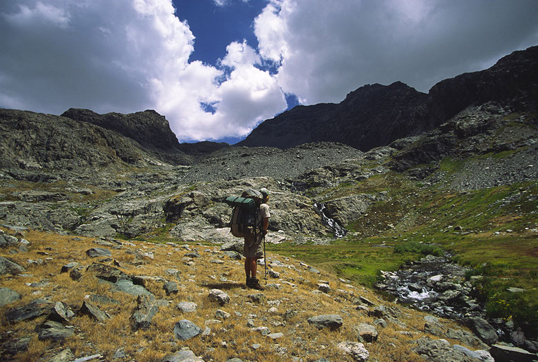
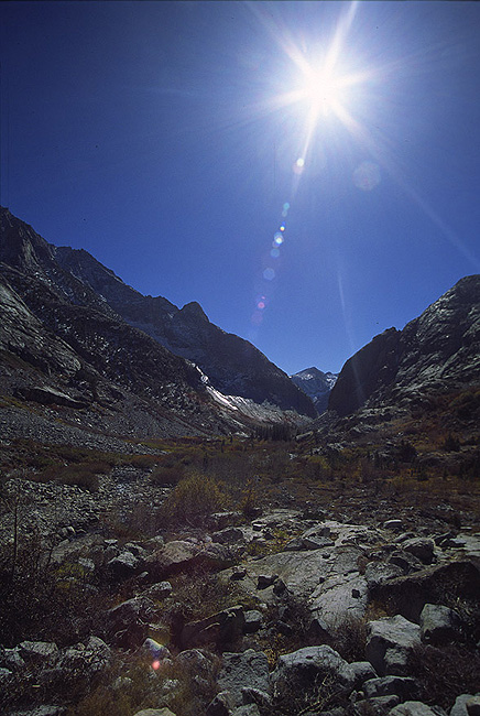
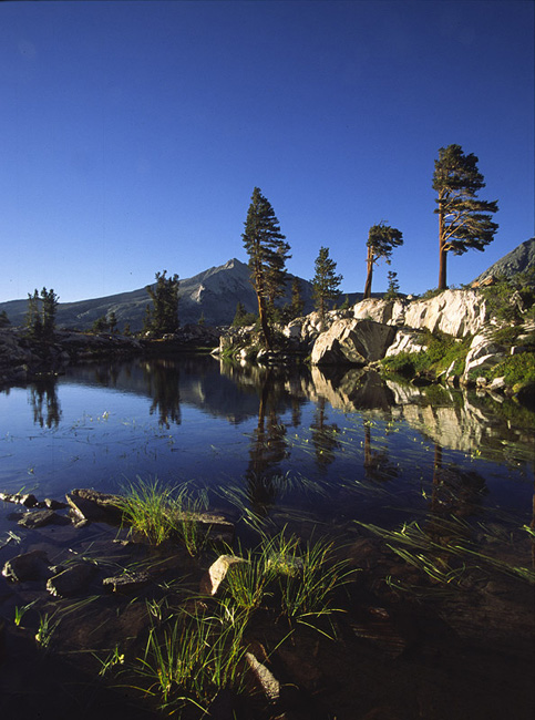 On into the White Divide. We crossed an exhausting pass on the shoulder of Finger Peak and surprisingly I was the only Buckeye who wanted to add the pain of climbing the peak. The pass was that exhausting, with frustrating big talus. But the peak was a fun scramble, and it felt good to leave the damn pack behind for awhile. From the summit of Finger Peak you get a nice look into Blackcap Basin with beautiful granite slabs and domes, scattered with lakes and thick forest. Immediately west of Finger Peak is an area almost entirely consisting of granite slabs—graceful, drawn out curves of stone overlapping one another, stained and striated, rough and ground smooth, with a few tarns of vibrant blue water. There is Blue Canyon draining away from you beyond that, and all the lakes of the upper canyon seem immaculately placed at your feet.
  Or I could look off the summit block straight down through air at talus far below the sheer northerly face of Finger Peak, then look up at the Ragged Spur painting a swooping ridgeline horizon to the east.
We spent a couple days camped at a beautiful little garden of a lake on the southwestern edge of upper Blue Canyon basin, and about all we did was wander, read, play hacky sack, and barely make it up a short unnamed high point near camp. After that we found ourselves at Tunemah Lake, where we immediately climbed the dramatic peak off to the east, that hangs above Goddard Creek. A classic little route follows a steep ridge to the summit, and we got to check out Goddard Creek below—it didn't look bad. That evening we watched thunderheads roll towards us from out over the deserts of Nevada and Death Valley, lit up like a wall of cotton candy. In the morning we packed up and got out of there under grey clouds over a rough little pass that starts off fine leaving Tunemah Lake, but gets terrible once you drop down over the other side. First steep dirt and basketball sized deathstar rocks, and then a field of big, frighteningly loose talus. When car sized talus is moving on you it gets real interesting really fast.
 But we made it on and over another easier little pass to Lake 9,797, just a mile or so downstream from Lake 10,232' where we were days ago. Such is the Buckeye Festival of Fools! Lake 9,797 sits at the upper edge of Goddard Creek, and from near its outlet you can look down the whole of Goddard Creek, as it drops some 2,700 feet in little over three miles to the junction with The Enchanted Gorge. "It looks fun actually," Nate said when he walked back into camp.
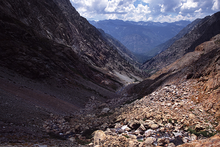
We left the next morning and entered Goddard Creek. I forgot something crucial at the lake but didn't realize it till we reached camp hours later.
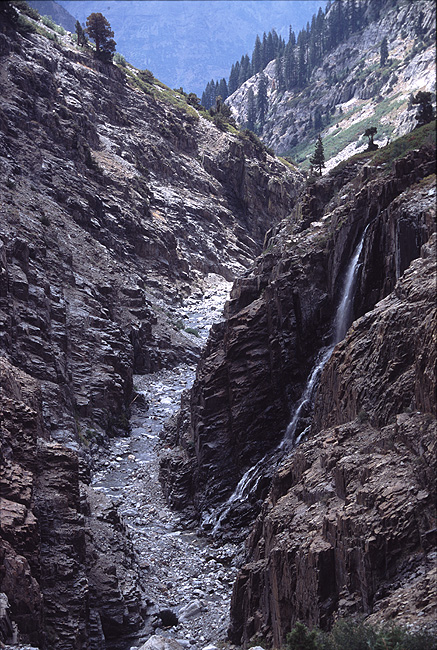
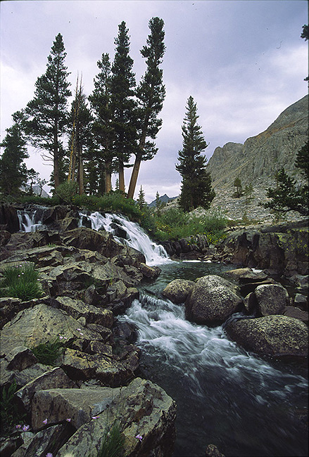
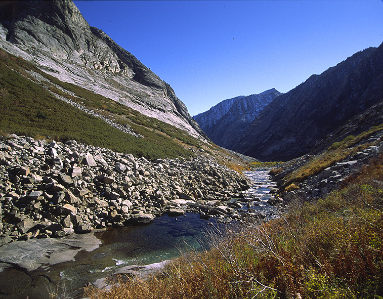
Immediately you are astounded. Stunned. I guess it comes on slow, with a couple beautiful cascading waterfalls in the creek, but then the creek rushes into a red rock gorge and the land starts to really drop away from you and you get past a bend in the creek and are suddenly staring down this ripped out rugged canyon with whitewater roaring at your feet. The White Divide spilling granite on your right, the Ragged Spur all dark and torn on your left. Big boulders down the creek bed—I started to worry a bit because of my heavier pack, with my guitar and tripod hanging off it. And it was hard for me, I was the slowest by far—the polished creek boulders were sketchy, and lots of scree, and talus and side hilling and just your general off-trail rugged work in the upper part of the canyon. It stayed like this for the first half of the descent, starting on the east side of the creek, then crossing to the west side of the creek at the first level area, and then down the west side as it drops off past a beautiful waterfall, staying close to the creek down grassy ledges into a gully that points you straight toward the main gorge of Goddard Creek. Stunned again. If not perpetually. A waterfall arcs from a side creek off the west cliff of the main gorge catching the light magically way out in front of you, framed by thousands of feet of relief, and puffy, building clouds. Unbelievable. Perhaps my most cherished scene of the High Sierra yet. You hurry towards it.
The main gorge holds a few waterfalls actually. Goddard Creek itself pours over two falls, plus the side creek falls. You can hike right above the gorge, cross the side creek falls near it's drop, and continue on down. We followed the edge of the gorge downstream, though at a certain point you have to angle high to get around some brush. There's no bushwacking necessary in Goddard Creek in low water season, there's only some that's hard to avoid right above the junction with The Enchanted Gorge. After the main gorge of Goddard Creek you drop down to a flat section of Cottonwood trees where we all walked in the nearly dry river bed for a while. It is at the downstream end of this area that its best to head up onto the east side of the creek and keep a high line, and you might be able to get around the manzanita field that you'll otherwise have to shwack through to get to the drier slope that drops you to the junction with The Enchanted Gorge. It was amidst this manzanita that I thought my backpacker guitar would surely die.

At camp, under giant Incense Cedars, looking up at gushing white sweeps of granite off the White Divide, and listening to thunder roll, I pulled out my tent, set it up, looked for the rain fly and realized that I'd forgotten it at Lake 9,797.
It's funny but all the Buckeyes were traveling in their own tents on this trip—a first. And Nate had a two man tent as his tent, so I crowded in there with him, and tried to decide whether we should burn our last layover day here so that I could hike back up Goddard Creek and get my rain fly. We did, and I left early the next morning to get the rain fly, and I got to experience Goddard Creek again, without a heavy pack, and retrieve what would otherwise have become a giant piece of nylon trash at Lake 9,797. After I got back with my rain fly, I also went off and spied out a start through the beginning of The Enchanted Gorge, something to get us going on the right track in the morning.
And it did. We were able to follow what appeared to be a Bear trail, probably also used by other hikers of the Enchanted Gorge, through most of the lower Gorge which is full of oak and brush, and avoided all but a minimal amount of bushwacking. The rest of the Gorge opened up out of some Cottonwood trees and was a very enchanting hike along a beautiful creek hemmed in tightly by thousands of feet of nearly vertical rise to the Ragged Spur on our left, and the Black Divide almost as steeply on our right. Starting early, we hiked in shade most of the way. These walls close in tight to the creek bed for the whole central part of the Gorge, and we switched from side to side of the creek getting our boots soaked. Nate just walked right through the creek and I said to hell with it and followed his example, the rocks were just too slippery and there was more water here than in Goddard Creek. Todd was the only one that made it through with dry feet somehow. Just below the first of the upper lakes, we stopped to check out a big cavern of blue ice melted out deep into an old, debris covered snowfield. We walked around inside of it, listening to the drips, and watched rocks fall into it through big cracks.
It was at these first upper lakes that we made our turn upwards and eastwards towards Little Piece of Heaven Meadow. It was steep, and the sun was hot, and we'd all worn pants because we'd expected some serious bushwacking in the Enchanted Gorge. Now we were rising above it, sweating our way out of it, looking down its dramatic cleavage. We found a miner's camp along this climb out. A shovel, a hole, a camp, and some other fragments of existence. And then, by god, we levelled out at our own Little Piece of Heaven Meadow. And it was, and it was.
Here Nate decided he would have to haul ass out to his truck the next day to get to San Diego and take care of various family related business. And the rest of us just took 'er easy and made it out in a couple days. Little Piece of Heaven sticks in my mind like a postage stamp, glued on there and strangely tasty. The sun seemed to hit the grass and make it glow supernaturally, and when you walked around the meadow, rolling up onto metamorphic slabs and whalebacks, the meadow looked so wonderfully placed, absolutely right, like a pillow for The Enchanted Gorge to sleep on.
* * *
Flash forward to just a week ago, October, yellow leaves getting blasted from the trees by winter's first real storm, the mountains all socked in. Nate's up in B.C., Ryan's applying for a doctoral program in Sociology down in Ocean Beach, Ted's off substitute teaching rooms full of fourth graders in Palo Alto, and Todd and I are ready to hike into The Muro Blanco—or at least Todd's ready.
I show up in the evening to our friend's Greg and Brooke's house in Bishop where we're all getting together for dinner, bottle of wine in hand, having just quit my job with a contractor I've known for six years. The night before I performed music with some friends of mine till the wee hours of the morning. Nothing's packed, but I've been to the grocery store and I've got all my food. "You didn't need to bring a bottle of wine Dave, we're going to drink the Laetitia you gave us a year ago," Brooke said when she saw my bottle in hand. But we proceeded to discuss my boss's crazy antics, his rediculous proclamations, and everything else about why I'd called it quits, and it was agreed that another bottle of wine was a good thing. We had an amazing dinner and drank all of the wine and beer, and it wasn't till around ten that night, feelin' pretty buzzed that I started packing for the trip. Storm clouds still billowed off the Sierra out in the darkness. I was worried about the cold weather, Greg gave me some fleece gloves for the trip, I packed an extra thick wool shirt, and an extra pair of socks—sort of wandering around with an attention deficit disorder looking at everything that needed to get organized and go into my pack. Don't forget anything important you idiot, I told myself, and near midnight I finally laid down on one of the couches for the night.
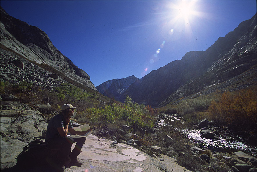
This trip was for real, with only four nights of food in our packs, and five days to make it from the Taboose Pass trailhead to the Sawmill Pass trailhead, both trailheads sitting out in the open desert scrub of the Owens Valley. As we got closer to Taboose Pass the first day, we met two John Muir Trail (JMT) hikers cutting short their trip because of the snow, and up on the pass itself we walked through ankle deep snow covering everything, with drifts up to shin deep. The deer had already beaten out a trail through the snow down the canyon, and we saw several that day. Walking down off Taboose Pass towards the head of the Muro Blanco was surreal, everything white and radiant, and a low angle sun cutting shadows and rich hues. We were good and tired setting camp that first night, after ten miles and 6,000 feet of gain, getting down into the woods along the South Fork of the Kings River, and falling asleep immediately after dinner.
In good old Buckeye fashion we got a 10 a.m. "alpine start" the next morning, heading into The Muro Blanco. The sun warmed up nicely, and the flawless blue dome of sky rewarded us with a perfect day. Not long after leaving camp we emerged from the thick forest into a nice view with Arrow Peak dusted in snow all the way down it's north face to the valley floor on our left, and the peaks of the Cirque Crest filling the skyline to our right. Lodgepole pines and aspens fill the valley, broken by areas of talus coming down off the canyon sides and pouring nearly to the river bank, the river running over granite bedrock in many places. There's the old John Muir Trail appearing in places underfoot in the upper canyon, guiding you, vanishing, reappearing, leading you to a dead end. Lower down the basins of the Cirque Crest are hanging valleys dropping off into bulbous granite domes and slabs to the valley. At one point we stopped next to the river where it fans out over a perfect 100 foot water slide into a big pool, but we didn't swim—the water was in the upper 30s. At our next stop along the river, Todd walked up to a dark spot in the slab and found that it wasn't just a dark spot, but a deep beautiful hole ground out of the granite, a large trout darted down from the surface and out of sight. Must have been the right combination of current and a good stone caught in the swirl that ground out this monster tube. You could've easily disappeared into it and who knows where you would've ended up, or what you would've become—was it perhaps the fountain of youth? Todd and I joked about this. Maybe we'd just stumbled upon the divine tank of youth, the reenergizing station, the bath that left you forever young.
The heart of the Muro Blanco presents a picturesque narrows, with both sides of the canyon coming to near a hundred yards apart at a curve in the river. A beautiful area of pines mixed lightly amongst aspens and birch and meadow grass all shades of yellow and orange and green with the river cutting through. The canyon wall of the actual "Muro Blanco" , or White Wall, as indicated on the topo map is impressive—blaring light-grey granite walls with several prominent aretes leaning over you as you walk, all graced this time with a dusting of snow. Most if not all bushwacking could be avoided throughout the upper and middle parts of the canyon. The river was low enough that we walked many sections right in the river bed itself hopping from rock to rock, sunlight shimmering off mirrors and reflections of sky between our footsteps.
All day we slowly approached the side canyon of Kid Creek, which lies where the Muro Blanco turns south, hoping that there would some place to camp there. Sure enough, tired and burnt from hours of problem solving and brush avoiding and rock hopping, we walked past Kid Creek and out onto an open granite slab with a perfect sandy camp spot and a view out to the walls above Woods Creek below. Here in the shadows, tucked in the bend, the canyon feels tight, with granite soaring way up and out of sight. A beautiful place to sleep. In the morning, as the sun performed its slow march down the canyon wall to our camp, I noticed some Black Oaks on the hillside, the leaves a rich orange, and long, curved Sugar Pine cones strewn about camp. We were dropping into different forest.
We had our worst encounter with brush in the Muro Blanco below this camp. With few options we found ourselves plunging into overhead birch for awhile, weaving around Black Oaks, sort of finding a path and then plunging into the brush again. But it was relatively short lived and gave way to classic forest, walking through fields of dried brown Bracken ferns, and strolling along the riverbed till we suddenly found ourselves on the Rae Lakes Loop Trail, and took a long break on the sandy beach at the bridge. We'd made it. Down another fine canyon! Todd and I cheered to The Buckeye Triple Crown: Goddard Creek, The Enchanted Gorge, and The Muro Blanco in one summer. Yeah that's Buckeye-in', that's the Festival of Fools alright. I pulled out my guitar, it's survived them all as well, and played some music for awhile. Todd read "The Hills Beyond" by Thomas Wolfe, and the river rolled, the river rolled.